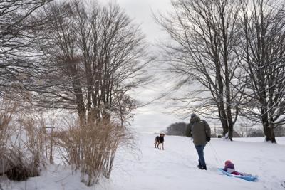
A man pulls his daughter through snow on a sled in Needham Park following a winter storm in Halifax on Christmas Day, Wednesday, Dec. 25, 2024. THE CANADIAN PRESS/Darren Calabrese
A man pulls his daughter through snow on a sled in Needham Park following a winter storm in Halifax on Christmas Day, Wednesday, Dec. 25, 2024. THE CANADIAN PRESS/Darren Calabrese
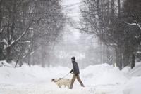
HALIFAX - Environment Canada says the bone-chilling cold sweeping across Canada will arrive in the Atlantic region early Saturday.
Residents of central and western Labrador will get the worst of it, with the wind making it feel like -50 C overnight and during the early morning hours. No relief is expected until Wednesday.
Across New Brunswick, the icy winds will make it feel like -30 C, though it will feel colder in the northwestern corner of the province, where the wind will make temperatures feel like -37 C on Saturday and Sunday.
In Prince Edward Island and northern Nova Scotia, a northwesterly flow of Arctic air will make it feel like -25 C to -30 C until Sunday morning.
The federal weather agency says those heading outdoors face an elevated risk of frostbite and hypothermia.
In Halifax, the municipal government says shelters across the region were increasing capacity to make sure enough emergency beds are available this weekend. As well, various outreach teams will be providing transportation to people who need shelter, offering hot beverages, sheltering supplies and certain "winter essentials" including hats, gloves and blankets to those who choose to remain outdoors.
Meanwhile, weather watchers are keeping an eye on a massive winter storm sweeping across the United States, which will likely bring some snow to Atlantic Canada early next week. Nova Scotia is expected to get as much as 20 centimetres of snow on Monday.
In Western and Central Canada, orange weather alerts have been issued for all of Saskatchewan and Manitoba, as well as northwestern Ontario, where the extreme cold is likely to cause significant disruptions. Residents in those areas can expect the wind chill index to reach between -45 C and -50 C, ahead of a slow warming trend this weekend.
“Extreme cold puts everyone at risk,” the federal weather agency says, adding that those outdoors face an elevated risk of frostbite and hypothermia. “Dress warmly. Dress in layers that you can remove if you get too warm. The outer layer should be wind resistant.”
This report by ��ɫtvwas first published Jan. 23, 2026.