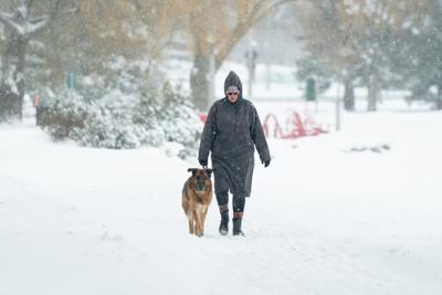
A person walks with their dog along Dow's Lake in Ottawa on Saturday, Jan. 13, 2024. Parts of northeastern Ontario should brace for the next blast of wintry weather as the area expects to see a near-20-degree drop in temperature over the next 24 hours. THE CANADIAN PRESS/Spencer Colby
A person walks with their dog along Dow's Lake in Ottawa on Saturday, Jan. 13, 2024. Parts of northeastern Ontario should brace for the next blast of wintry weather as the area expects to see a near-20-degree drop in temperature over the next 24 hours. THE CANADIAN PRESS/Spencer Colby
TORONTO - Parts of northeastern Ontario can expect to see a nearly 20-degree drop in temperature over the next 24 hours thanks to a blast of wintry weather.
Environment Canada meteorologist Geoff Coulson says a cold front moving to the southeast is expected to push temperatures down in Timmins from around -4 C early on Wednesday to -23 C by Thursday morning. Temperatures are also expected to drop at similar rates in Wawa, Temiskaming, Chapleau and Kapuskasing over the same time frame.Â
The plummeting temperatures in northern Ontario are coupled with snow squall warnings issued throughout the area for brief but intense snowfall that could amount to 10 centimetres.
Colder air is also coming to parts of southern Ontario over the next few days, with temperatures expected to drop to a low of around -20 C by Friday in the Ottawa area, Coulson said.Â
The Greater Toronto Area is shielded by the Great Lakes and will avoid most of the nosedive, but Torontonians should also bundle up as the city is expected to see a daytime high of -5 on Thursday before dipping down to a low of -11 C.Â
The temperatures in southern Ontario mark a stark difference from what's normal across the region, Coulson said. The usual December average high and low temperatures for Ottawa are -1 and -8 C, and Toronto's longtime average temperatures for early December sit at 3 C as the high and -4 C as the low, Coulson said.
"This is an early December temperature plunge or blast of Arctic air. It's significantly colder than normal for this time of year," he said.Â
Coulson said very cold air moving across the warmer water of the Great Lakes is also expected to bring another round of lake effect snow to the Georgian Bay area. Lake effect activity is expected Wednesday in the Parry Sound area, which is then expected to blow to Barrie and parts of Huron County late Wednesday and into Thursday.Â
Environment Canada has said that multiple rounds of snow last week dumped just shy of 60 centimetres off Lake Huron.Â
Coulson said it's still too early to tell whether records have been set for total snowfall across Ontario's snowbelt so far this year, but it has been "a very active start to the lake effect season" after such a mild fall.Â
This report by şĂÉ«tvwas first published Dec. 3, 2025.